
Thaw and Heavy Rain Raise Flooding Risk in Ottawa
Ottawa is facing an elevated risk of localized flooding this weekend due to heavy rainfall, above-freezing temperatures, and frozen ground that cannot absorb water effectively. According to the forecast, 20 to 30 mm of rain could fall in the capital on Saturday, with thunderstorms possible in some areas.
The situation is being worsened by rapid snowmelt. As a result, water may accumulate on roads, in low-lying areas, and near rivers and streams. Residents are being urged to remain cautious and avoid driving through flooded sections of roadway.
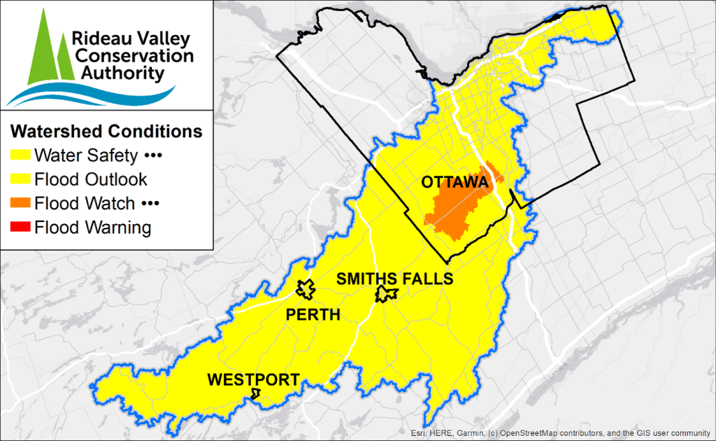
Several conservation authorities across the region are closely monitoring water levels. The Rideau Valley Conservation Authority has issued a flood watch for the North Gower area, particularly near Stevens Creek and Taylor Drain, where water levels could approach critical thresholds. Officials are also warning about possible ice movement and the formation of ice jams on larger bodies of water.
Similar warnings are in effect in other parts of the region. The Mississippi Valley Conservation Authority says flooding is possible near the Carp and Mississippi rivers, while the South Nation Conservation Authority notes that widespread flooding is not expected at this time, though conditions could change quickly depending on the intensity of the rainfall.
Temperatures are expected to rise to 11°C on Saturday before dropping to about 5°C by Sunday.